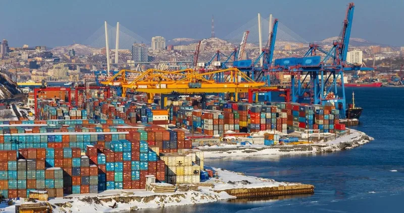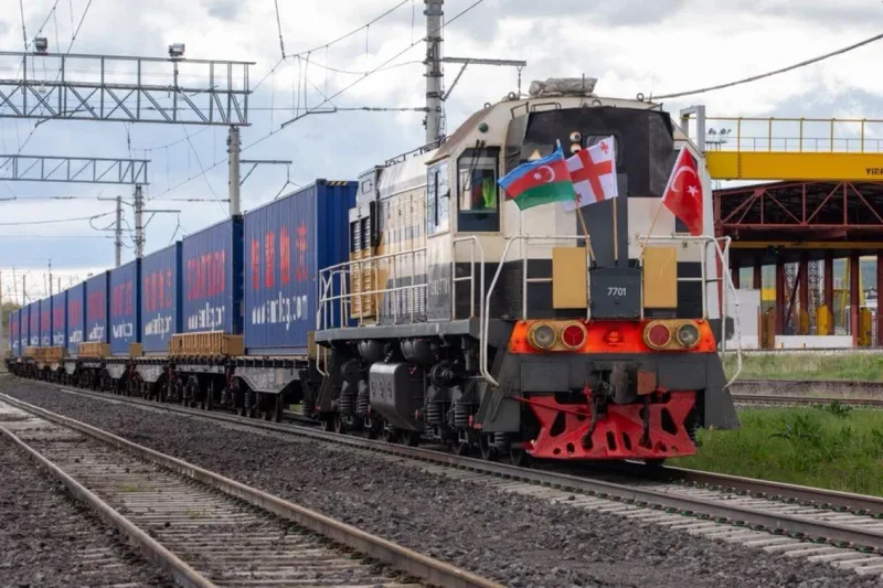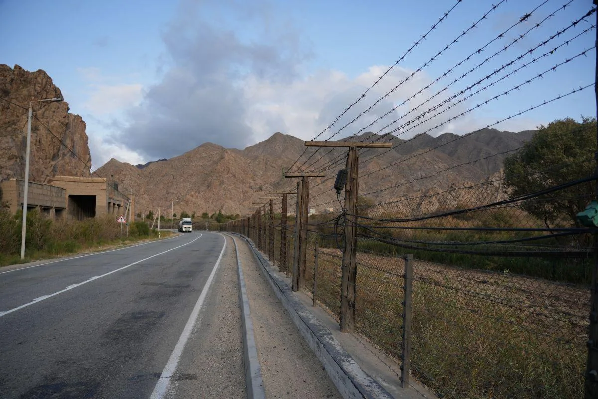
For more than thirty years, the map of the South Caucasus was read as a military map. Borders indicated not so much where one could travel as where roads became impossible. Between Armenia and Azerbaijan, infrastructure inherited from the Soviet Union had been severed by war. The border between Armenia and Turkey was closed. Railway lines sometimes stopped only a few kilometres from territories they could no longer reach. As the conflict over Nagorno-Karabakh became entrenched, isolation itself became part of the regional order. That order is beginning to change.
The rapprochement between Yerevan and Baku does not mean that all the consequences of several decades of war have disappeared. The text of the Agreement on Establishment of Peace and Inter-State Relations was initialled in Washington on August 8, 2025, but its full implementation remains a political process. It nevertheless establishes principles that would have appeared almost unreachable only a few years earlier: mutual recognition of sovereignty and territorial integrity, the absence of future territorial claims, border delimitation, and the possibility of agreements on economic cooperation, transit and transport.
Yet the most important consequence may lie elsewhere. Once war ceases to occupy the centre of the equation, the Caucasus rediscovers its geography. And that geography is that of a crossroads. 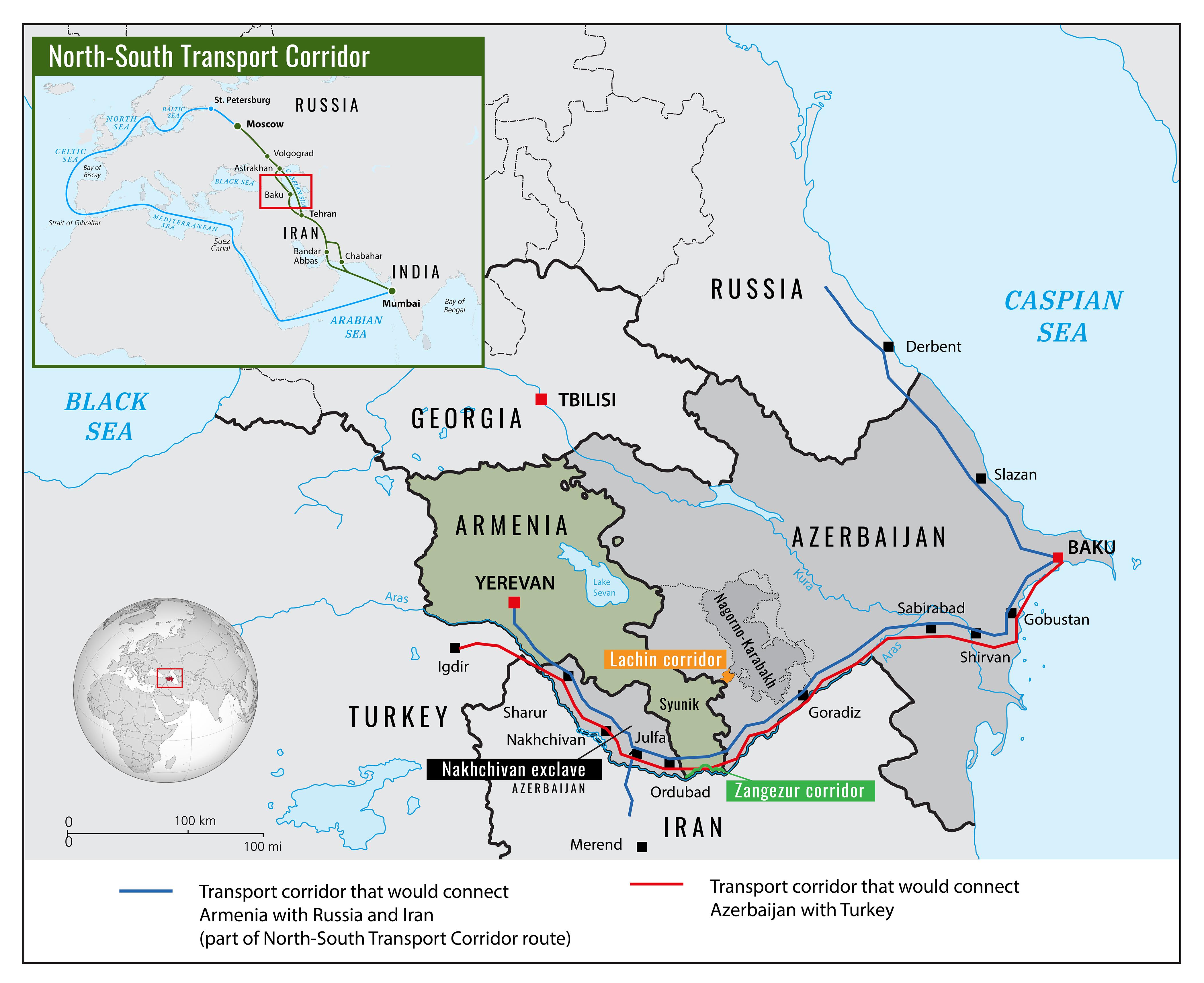
The Return of the Routes
On a map of Eurasia, the South Caucasus looks tiny. Between the Black Sea and the Caspian, however, only a few hundred kilometres separate several vast economic spaces: Russia to the north, Turkey and the Mediterranean to the west, Iran and the Persian Gulf to the south, and the Caspian followed by Central Asia to the east.
For centuries, this position made the region a space of circulation as much as a battlefield. The Russian, Ottoman and Persian empires fought over it precisely because controlling the mountains and valleys of the Caucasus also meant controlling its passages.
The collapse of the Soviet Union and the conflicts that followed fragmented this geography.
Georgia gradually became Azerbaijan’s principal western outlet. Oil pipelines, gas pipelines, roads and railways bypassed Armenia to connect the Caspian with Turkey. Armenia, meanwhile, developed an economy constrained by the closure of its borders with Azerbaijan and Turkey, relying primarily on its Georgian and Iranian gateways.
Peace could begin to dismantle this architecture of circumvention.
The most spectacular project concerns southern Armenia. The mechanism now known as TRIPP — the Trump Route for International Peace and Prosperity — is intended to develop a connection across Armenian territory capable of linking western Azerbaijan with Nakhchivan and, beyond it, with Turkish networks.
The crucial point is legal as much as logistical. Under the framework negotiated by Yerevan and Washington, this strip of territory would not be removed from Armenian sovereignty. The texts explicitly provide for the preservation of Armenia’s sovereignty, territorial integrity and jurisdiction.
That is precisely what transforms a former object of confrontation into an infrastructure project.
According to the framework published in January 2026, the company responsible for developing TRIPP is to be 74% owned by the United States and 26% by Armenia, with an initial development right lasting 49 years. The Armenian-American framework agreement was subsequently signed in June 2026.
Those figures tell a story far larger than that of a financing arrangement.
A Caucasian route is becoming a geopolitical asset.
Armenia Can Change Its Function
For Yerevan, the stakes extend far beyond the construction of a road or railway.
Modern Armenia has developed within a geographical paradox. It sits in the middle of a region crossed by growing flows between Europe and Asia while remaining largely outside those flows.
A lasting peace with Azerbaijan, combined with normalization with Turkey, could reverse that situation.
Armenia would obviously not become a new continental Singapore overnight. Neither volumes, infrastructure nor geographical constraints permit such a comparison. But its economic function could change: from the end of a network, it could become a transit territory.
The difference is considerable.
A landlocked country is subject to the decisions of its neighbours. A transit country can begin to monetize its position between them.
The proposed reconstruction of the Gyumri–Kars railway is almost symbolic in this respect. In their strategic partnership charter, Armenia and the United States describe it as a step that could help unlock the region’s economic potential. The same document explicitly connects transport development with energy and digital infrastructure.
Peace would therefore accomplish something that political maps struggle to represent: it would shorten distances without moving cities.
Kars would not become geographically closer to Gyumri. Baku would not move closer to Yerevan. But the economic and political cost of crossing those distances could collapse.
That is how economic geography changes.
Turkey Rediscovers Central Asia
For Ankara, the transformation would be particularly advantageous.
Turkey has long maintained an exceptionally close strategic relationship with Azerbaijan. But between Turkish territory and the Azerbaijani heartland lie Armenia, Georgia and the peculiar geography of Nakhchivan.
Reopening communications across southern Armenia would provide an additional continuity towards Azerbaijan and, beyond it, the Caspian.
On the other side of the Caspian lies another space: Kazakhstan, Turkmenistan, Uzbekistan and Central Asia more broadly.
This is where the Caucasian question intersects with a much larger continental transformation.
The Middle Corridor — the transport axis connecting China and Central Asia with Europe through the Caspian, the Caucasus and Turkey — has acquired greater importance since 2022. The war in Ukraine and the deterioration of relations between Russia and Europe have increased the strategic value of routes capable of bypassing Russian territory.
Armenian-Azerbaijani peace would add another branch to this architecture.
The Caucasus would no longer possess only an east-west corridor running through Azerbaijan, Georgia and Turkey. Several routes could gradually complement — or compete with — one another.
Turkey would therefore gain something more important than another road to Baku: it would strengthen its role as the western terminal of networks connecting Europe to Central Asia.
Turkish geography, already advantageous between Europe, the Mediterranean, the Black Sea and the Middle East, would acquire an additional dimension.
Iran Reads the Map Differently
For Tehran, the same development produces an almost opposite interpretation.
Iran has always regarded the South Caucasus as part of its immediate strategic depth. Its short border with Armenia notably allows it to retain access to the Caucasus without depending on either Turkey or Azerbaijan.
Any transformation in the status of the routes crossing Armenia’s Syunik province is therefore watched particularly closely.
The issue is not simply trade.
It is regional balance.
Infrastructure connecting Azerbaijan more directly with Turkey would mechanically strengthen an Ankara–Baku axis whose influence Tehran already monitors carefully. American economic involvement in the development of TRIPP adds another dimension: an external power becomes involved in strategic infrastructure in southern Armenia, immediately adjacent to Iran’s northern neighbourhood.
The compromise being pursued is precisely intended to separate the opening of communications from extraterritoriality.
The route can exist without the border disappearing.
For Yerevan, that distinction is fundamental. For Tehran, it is probably indispensable.
But it does not eliminate the strategic transformation: the more deeply the Caucasus becomes integrated into Turkish, European and American networks, the less Iran can regard its northern environment as relatively insulated from Western competition.
Russia Loses Its Monopoly on Passage
It is in Moscow, however, that the new map raises the deepest question.
For much of the post-Soviet era, Russia was not simply a power present in the Caucasus. It was the indispensable architect of its balance.
It maintained a military alliance with Armenia, stationed forces on Armenian territory, controlled or influenced several strategic infrastructures and retained close relations with Azerbaijan. After the 2020 war, Russian soldiers were even deployed as peacekeepers around Nagorno-Karabakh.
That architecture has largely eroded.
Azerbaijan’s September 2023 offensive, the near-total exodus of the Armenian population of Nagorno-Karabakh, and the subsequent early withdrawal of Russian forces demonstrated the limits of Moscow’s ability to preserve the old equilibrium.
The diplomatic process itself then moved elsewhere.
The peace text was initialled in Washington. The most sensitive transit project is being developed within an Armenian-American framework. The European Union openly supports normalization. Armenia is deepening its political, economic and security relationships with the United States and Europe.
Russia is not disappearing from the Caucasus.
Geography makes that impossible.
It remains the major northern neighbour, an important market, an energy and logistics actor, and a regional military power. But it risks losing something subtler: its role as the unavoidable intermediary.
For years, even Moscow’s adversaries had to operate within a regional architecture in which Russia held several of the keys.
The emerging architecture could distribute more of them.
Washington Enters the Geography
American involvement is remarkable precisely because it no longer stops at diplomacy.
Washington is not merely seeking to guarantee an agreement. It is entering the infrastructure.
A majority American stake in the TRIPP development company would give the United States a material position in the Caucasus. The partnership signed with Armenia also extends to transport, digital infrastructure, energy and critical minerals. A bilateral framework adopted in May 2026 explicitly identifies TRIPP as a potential route for transporting critical minerals originating in the South Caucasus and Central Asia.
The logic then becomes clear.
The Caspian and Central Asia possess significant energy and mineral resources. Europe is seeking routes and supplies less dependent on Russia. Turkey wants to consolidate its role as a continental bridge. The United States wants to diversify Western strategic supply chains.
The Caucasus lies directly between these interests.
Peace between Armenia and Azerbaijan therefore creates more than a diplomatic opportunity.
It potentially releases a piece of geography that conflict had immobilized.
Europe Discovers Another Eastern Frontier
For the European Union, this development completes a transformation already underway.
For years, Brussels tended to see the Caucasus as a peripheral part of its neighbourhood policy: close enough to matter, but too unstable to become a genuine area of economic integration.
Energy began to change that perception.
Azerbaijan became a more important supplier to Europe. Infrastructure crossing Georgia and Turkey gave the Caspian greater strategic value. Then the rupture in European energy relations with Russia after 2022 accelerated the search for alternative routes.
Connectivity is now becoming the second stage of that policy.
A region in which the Armenian-Azerbaijani and Armenian-Turkish borders gradually became passable would provide greater redundancy to the networks connecting Europe with the Caspian and Central Asia.
That matters because the value of a corridor is not determined solely by its length.
It depends on its alternatives.
A single route creates dependency. Several routes create a network.
And in a world where straits, sanctions, wars, sabotage and commercial rivalries regularly disrupt supply chains, redundancy has economic value of its own.
From Border to Network
It would nevertheless be premature to treat this new geography as an accomplished fact.
Infrastructure must be financed, constructed or rehabilitated. Customs procedures must be negotiated. Borders must be delimited. Populations must accept normalization after decades of violence. Governments will have to demonstrate that economic benefits can survive political change.
Above all, a road does not abolish history.
The Nagorno-Karabakh conflict produced wars, mass displacement and trauma that will not disappear with the opening of a border crossing.
Yet the transformation underway remains considerable because it gradually changes the nature of competition itself.
For three decades, every infrastructure project was evaluated through the prism of war.
Tomorrow, war may increasingly be evaluated through what it would destroy in infrastructure.
That is a fundamental difference.
When a closed border carries almost no trade, closing it again costs relatively little. When it carries railways, pipelines, fibre-optic cables, investment and thousands of commercial movements, the cost of rupture rises.
Economic geography can then begin to produce its own form of deterrence.
Peace Does Not End Rivalry
The Caucasus will not become a pacified space in any naïve sense.
Quite the opposite.
The more connected the region becomes, the more powers it will attract.
Turkey will seek to deepen its access to Azerbaijan and Central Asia. Iran will try to preserve its access to the Caucasus and prevent strategic encirclement. Russia will seek to retain influence in a region it has historically regarded as essential to its security. The United States will try to consolidate the emerging infrastructure. The European Union will attempt to anchor the region more firmly to its commercial and energy networks. China, finally, will inevitably watch any additional route capable of connecting inner Asia with European markets.
Peace therefore does not end geopolitics.
It changes its object.
Territory remains important, but rails, roads, electricity grids, pipelines, cables and border crossings become increasingly important alongside it.
That may be the real historical rupture.
For decades, the South Caucasus was a region where roads stopped at borders because borders mattered more than roads.
It could become a region where powers compete precisely over the ability to cross them.
The map will have barely changed.
Armenia will remain between Turkey and Azerbaijan. Iran will remain to the south. Russia will remain to the north. The Caspian will remain to the east.
But political geography is never merely a matter of mountains, borders and kilometres. It also depends on what can cross them.
For thirty years, the central question in the Caucasus was who would control the territories.
If peace holds, the next one will be who controls the routes.
Main Sources
- Ministry of Foreign Affairs of Armenia, Agreement on Establishment of Peace and Inter-State Relations between the Republic of Armenia and the Republic of Azerbaijan, initialled August 8, 2025.
- Ministry of Foreign Affairs of Armenia, Framework Agreement on Strategic Cooperation Concerning the Trump Route for International Peace and Prosperity, 2026.
- Armenia–United States, Implementation Framework for the Trump Route for International Peace and Prosperity, January 2026.
- Armenia–United States, Charter on Comprehensive Strategic Partnership, 2026.
- Armenia–United States, cooperation framework on critical minerals and rare earths, May 2026.
- European Council and European Commission, statement on the Armenia–Azerbaijan peace process, August 8, 2025.
Atlas Limits Research Desk
Atlas Limits’ editorial and analytical desk.